Labor Day and a Tour of Northern California
This Labor Day we took the three day weekend and traveled roughly 900 miles on a quest to see the variety of the far northern parts of California.

Starting early Saturday morning we drove the BusBus from Stockton to Lassen National Park, a park dedicated to the 4 major types of volcanoes (shield, cinder cone, dome & plug, and composite). Mt. Lassen is also the southern extent of the Cascade Range volcanoes.
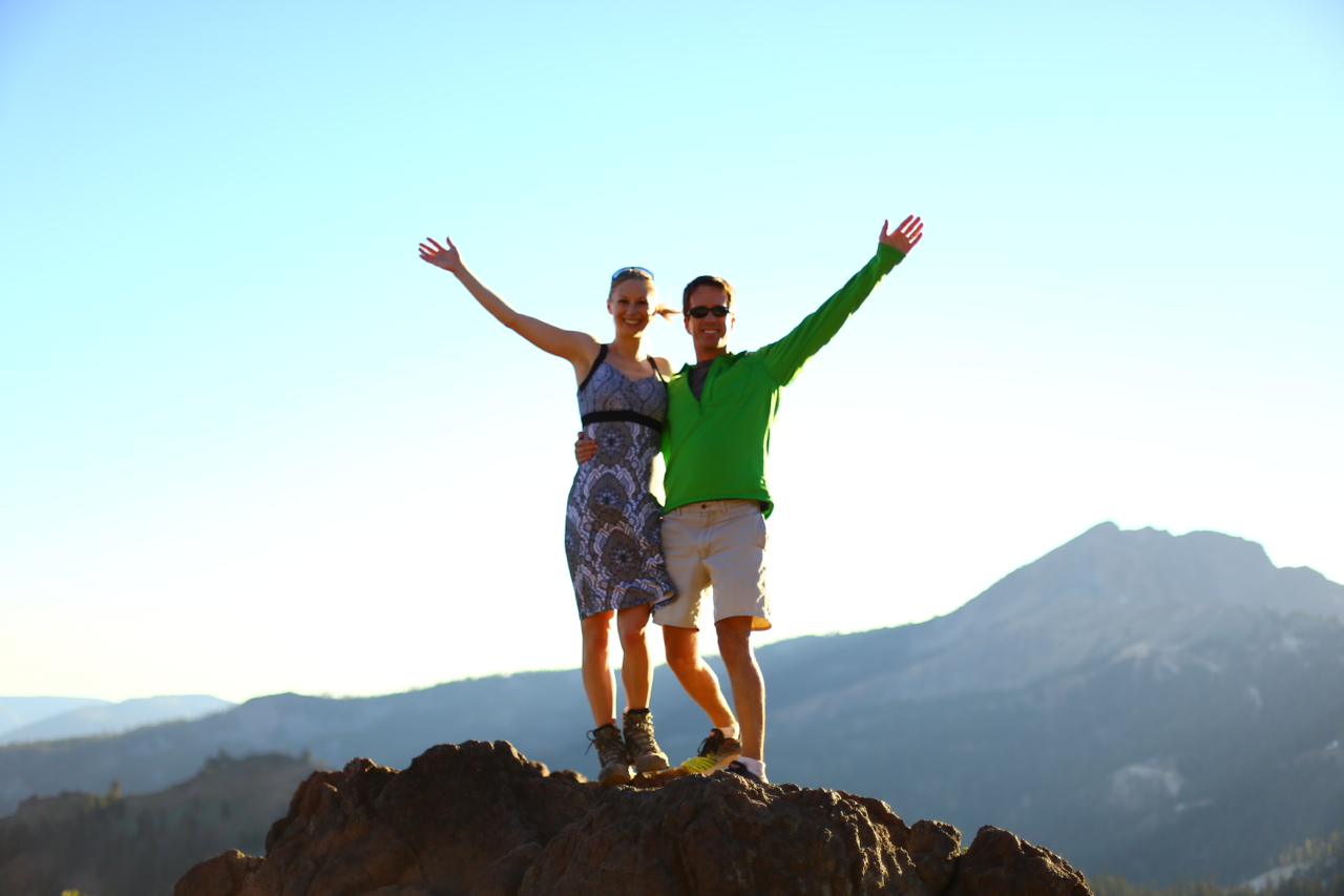
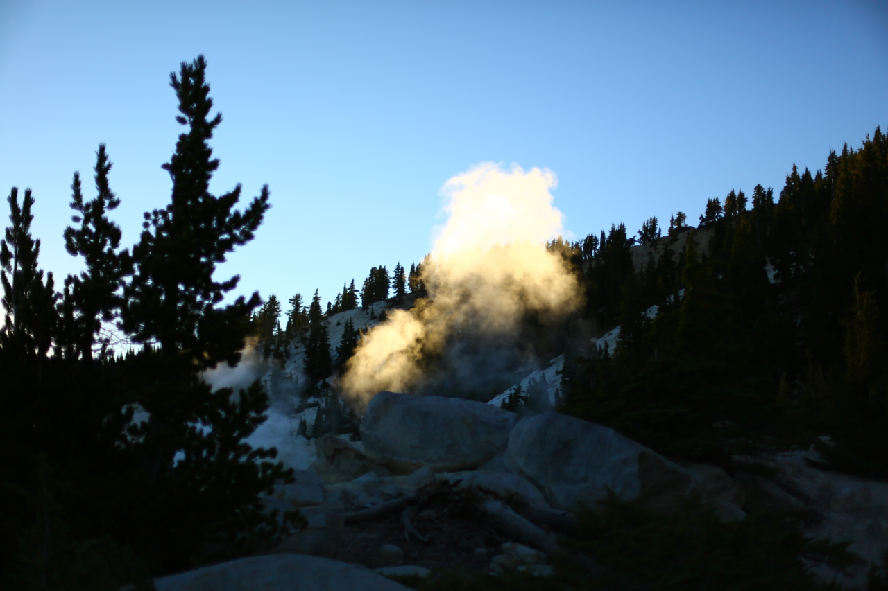
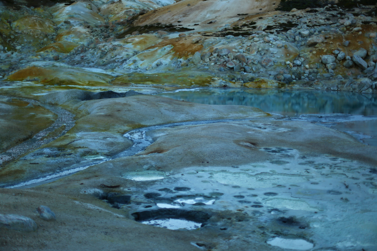
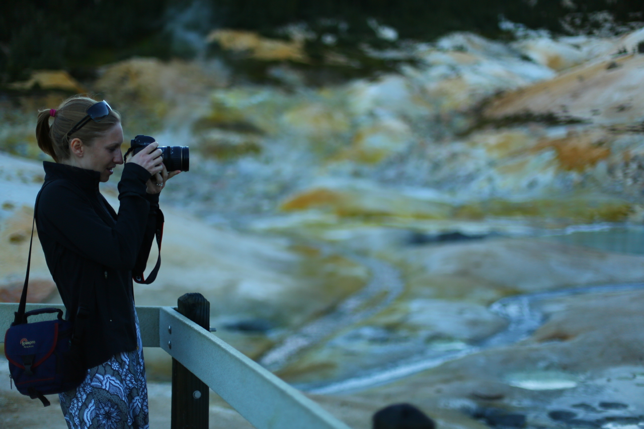
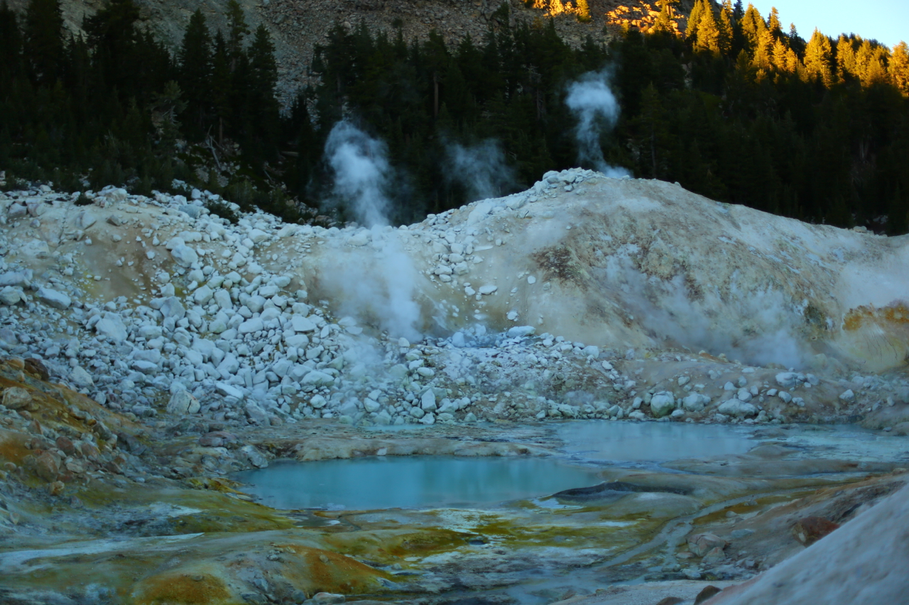
With a mid-day arrival, we skipped the crowded road-side attractions and headed to the volcano’s peak. The climb was mild and, given the late time of day, more people were headed down than up making for a reasonably empty trail. The top of the mountain was craggy and surprisingly snow-covered. The last eruption was in 1916, making the rock at the summit the youngest rock in California. After crawling around the sharp crags and gullies of the crater, we descended and headed to the Bumpass Hell. This site is a network of boiling mud pits, fumeroles, and clay pots fed by steam and boiling water from the volcano. After sunset, we found a quiet trailhead to tuck in for the night.
Of course, the night was just getting started and the wonders of the BusBus allowed us to stay up with snacks of peanut butter and jelly sandwiches, beer, and cider while we played Dominion, the card game.
The following morning we were up with the sun and back on the road, finishing our tour of Lassen National Park. Also up with the sun were a group of deer; the creatures were our first wildlife of the trip. The volcano adventure completed, we were off to Shasta Lake. Here we toured the lake and not the volcano. The reservoir is home to the second tallest concrete dam in the U.S. and it is the principal reservoir in the Federal Central Valley Project water system. Constructed during World War II, the dam served to provide the power necessary to keep the ship factories running in the Bay Area. Today, however, we were here to see something completely different… caves!
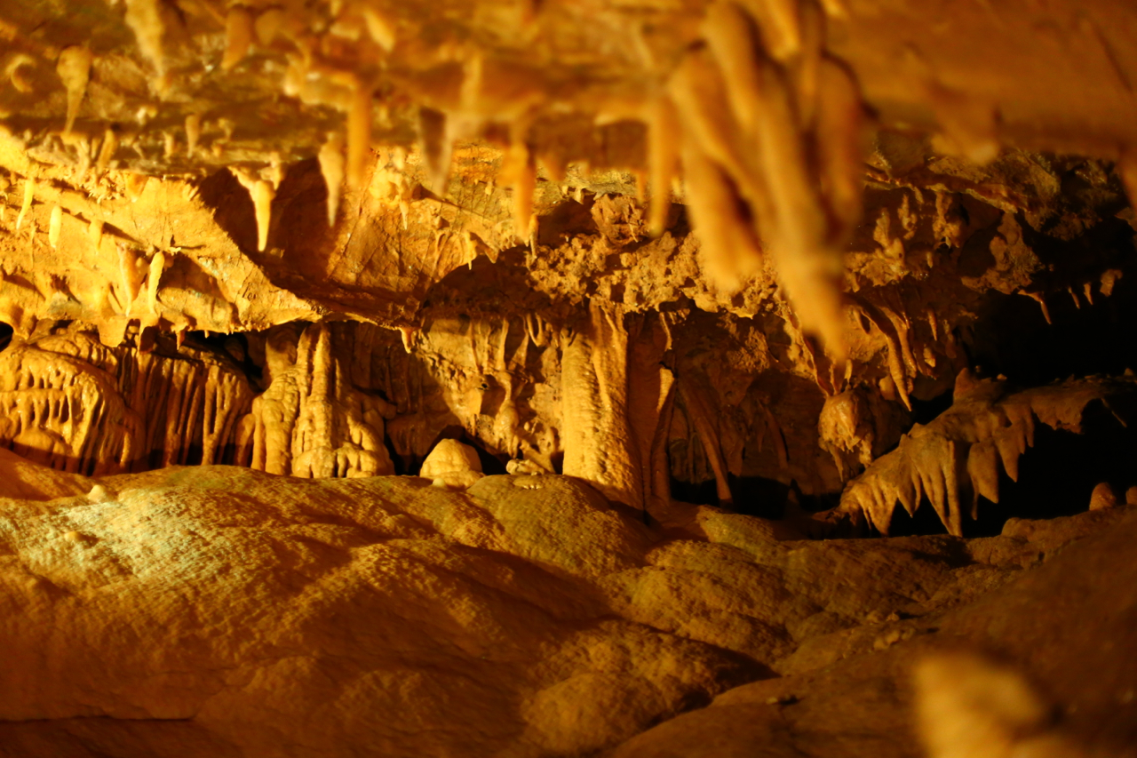
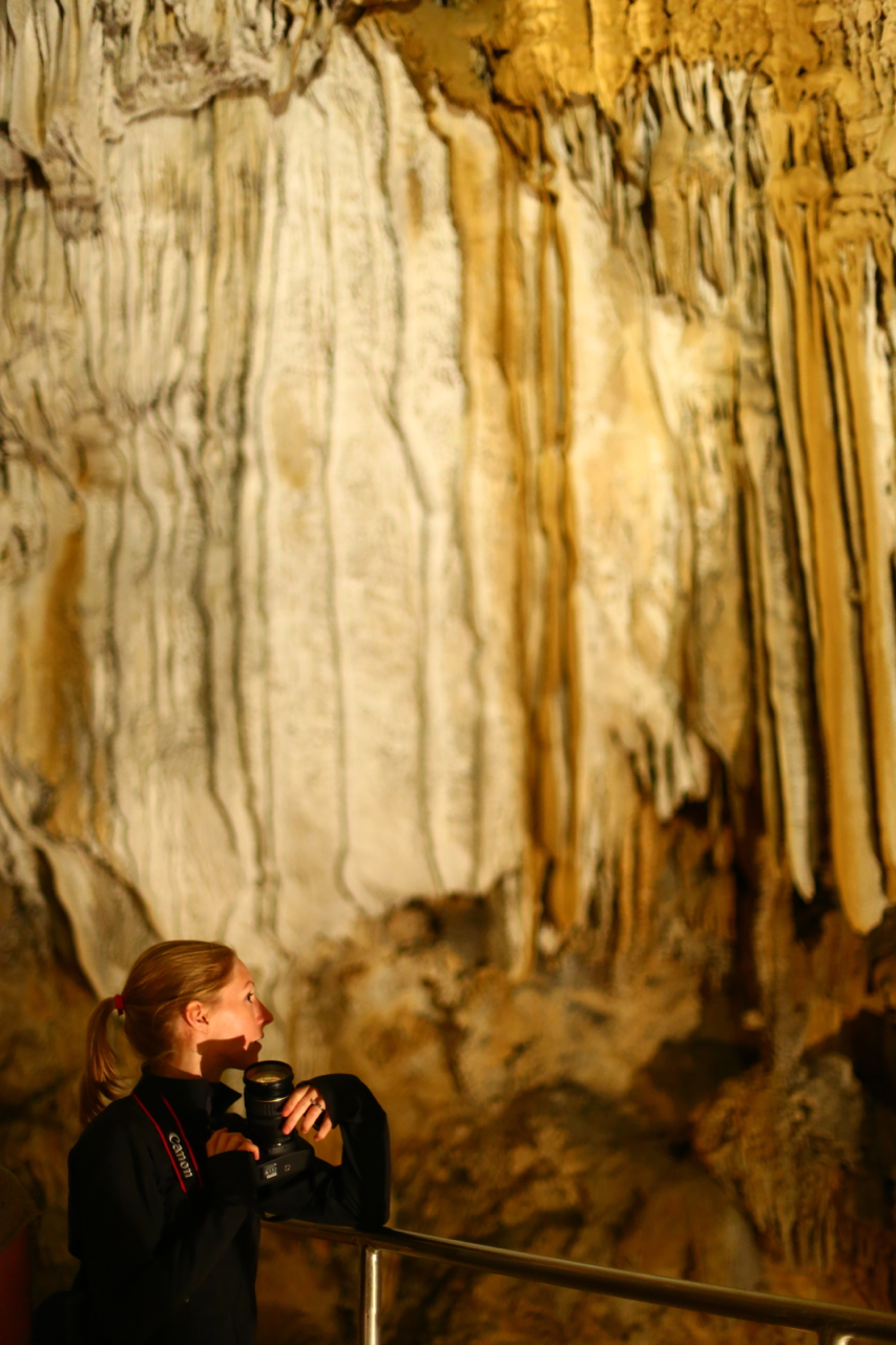
Privately owned Shasta Caverns is a cave system about 800 feet above the lake’s surface along the southeastern shore. It was discovered by an employee from the U.S. Bureau of Reclamation and was explored for years before being managed as a tourist attraction. Currently the caverns run vertically through the mountain, with chambers connected to one another by blasted tunnels and stairs. Some of the stalactites are 2,000 years old according to an estimate provided by the University of California at Davis. Formations represented in the caverns include curtain stalactites (“cave bacon”), helictites (“cave spaghetti”), standard stalactites (“ice cream cones”), soda straws, and flowstone (“cave ice cream”). It seemed to me that the individual leading our tour was hungry for lunch.
Done with our cave tour and back at the BusBus, Karen and I were off again for the next part of our adventure. We were headed to the coast and Redwood National Park near Eureka. On the way there we passed through Redding and then Whiskytown Reservoir. Since it was a nice day out and the lake had some good coves without boat traffic, Karen and I decided to take advantage of the big water and work on our open water swimming skills. So we hopped in the water and swam a half mile. Not too shabby for a random afternoon.
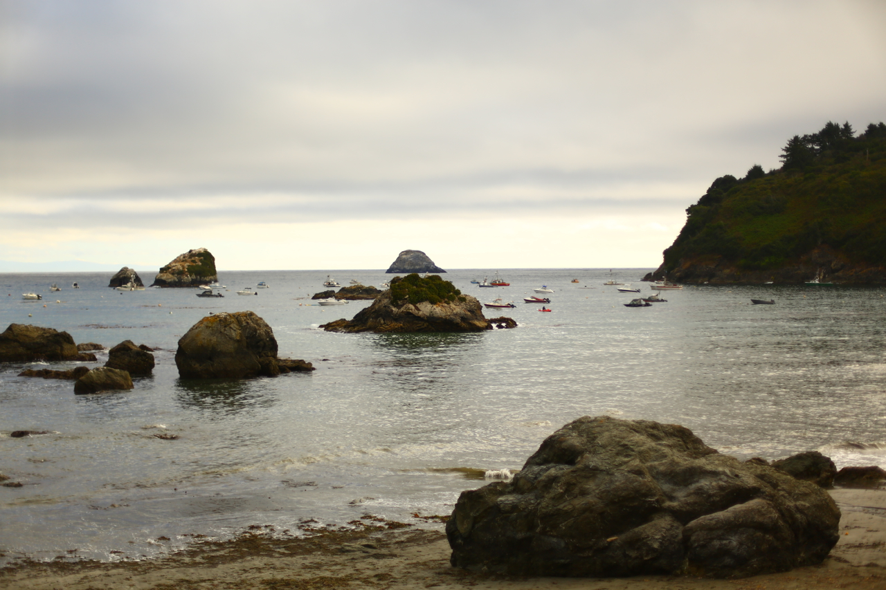
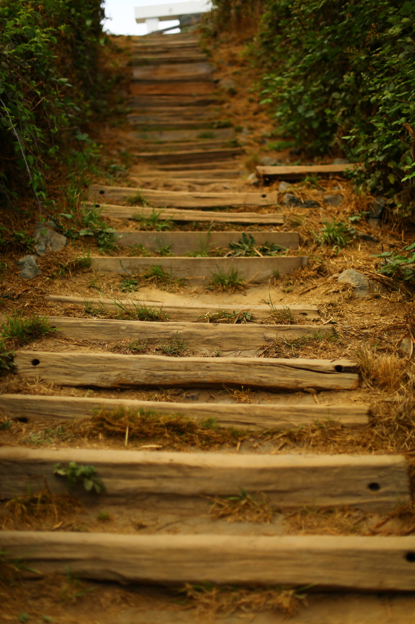
Up and over the Coastal Range and we came upon the Pacific Ocean. Heading north we drove to a little alternative town called Trinity. Here, we parked and walked around the beaches and town, enjoying the ocean air and mild temperatures. There were seals perched upon rocks, keeping safe from the sharks, and wild blackberries grew everywhere. Snacking and walking, we enjoyed a little time out of the car. Walking to the pier, we had local seafood and then started looking for a place to spend the night. A few miles north of the town Karen found a small cluster of homes overlooking the Pacific. The area had a wide road with very little traffic, and a great location. We fell asleep to the sounds of crashing surf.
The following morning we were again up with the sun and on the road headed north, catching our first (but not last) sight of Roosevelt elk. Conveniently, this first herd was standing directly in front of a giant billboard stating that this location was an elk crossing. Stopping shortly thereafter in Orick for breakfast at the Palm Cafe based upon local recommendation, we feasted on eggs, toast, and OJ before heading into Redwood National Park at the Ladybird Johnson Grove. Here we wandered virtually alone for over an hour marveling at the tremendously tall trees. We saw banana slugs aplenty, several bright yellow snails the size of a half-dollar, some scurrying chipmunks, and best of all we saw a tree dropping its cones. In fact, we stood nearby and watched for several minutes as cones the size of golfballs zinged past us and ricocheted off of logs, rocks, the ground, but luckily not us. You could hear the whistle of the cones as they fell. It was quite surreal to be there all alone as the forest went about its business.
Back on the road, we drove the Newton B. Drury Scenic Parkway. This road parallels Hwy. 101 and cuts through the heart of an old growth redwood grove. The views from the car are amazing and, with the BusBus providing an adequate excuse to drive slow, we crept along keeping eyes glued to the amazing trees we were passing.
Eventually we rejoined Hwy. 101 and headed still farther north. Over breakfast, the locals were telling us about how large this year’s salmon run is. It was occurring as we sat there eating our eggs. We were encouraged to go take a look. So, we drove initially to the Klamath River Overlook. This is a state park high on the bluff overlooking the mouth of the Klamath River. There was a heavy marine layer, however, and the overlook was a good 1/2 mile into the clouds. So, we turned around and headed to the heart of the activity – a impromptu encampment of thousands of fishermen and fisherwomen. There were concessioners smoking fish, serving coffee, fixing boats, fixing nets, and just about everything else you can imagine being needed where fishing is the first and last thing on everyone’s mind. The fish were indeed running, but it was hard to get a good photo. The river was criss-crossed with nets, slowing passing boats to a crawl. The shores were heavy with rods and buckets, everyone looking to strike a 4 foot salmon.
Leaving the craziness, we were headed south toward Eureka. Just as we drove onto the bridge over the Klamath River, Karen looked down in time to see a young black bear cruising the riverbank, no doubt looking for a fish. Surprisingly, this bear was no further than 1000 feet from a very heavily populated campground. Neither the campers nor the bear seemed to notice one another. We drove south.
Passing Eureka, we entered the Avenue of the Giants; this road is another scenic bypass to Hwy. 101, paralleling the highway for tens of miles. On this road we passed through many redwood groves each with amazing trees and views. Founders’ Grove is the first grove we decided to walk around. The tallest tree, the Founders Tree, is here. There are also many downed trees that you can walk along, often connecting one fallen tree to the next. Another stop we made was at Rockefeller Grove. This grove is off the main stretch of road and was vacant. We were able to walk the entire grove without running into a single person. This grove also contains 40 of the top 100 tallest trees in the world. The sheer density of tall trees with very little undergrowth really gave this grove some height and distinction.
Our tree exploration done, we were on the road headed home via the Eel River valley and Capay Valley. All said and done, it was an amazing road trip and I can’t wait to share it with anyone who feels the desire to spend 3 days in a car exploring the state.